


Precinct 11, Powder River County, Montana
About
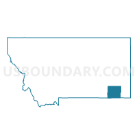
Outline

Summary
| Unique Area Identifier | 612211 |
| Name | Precinct 11 |
| County | Powder River County |
| State | Montana |
| Area (square miles) | 879.04 |
| Land Area (square miles) | 878.87 |
| Water Area (square miles) | 0.17 |
| % of Land Area | 99.98 |
| % of Water Area | 0.02 |
| Latitude of the Internal Point | 45.29993110 |
| Longtitude of the Internal Point | -105.30751130 |
Maps


Graphs
Select a template below for downloading or customizing gragh for Precinct 11, Powder River County, Montana


Neighbors
Neighoring Voting District (by Name) Neighboring Voting District on the Map
- CAMPLEX-ENERGY HALL Voting District, Campbell County, WY
- NEW HAVEN Voting District, Crook County, WY
- Precinct 1, Powder River County, MT
- Precinct 1, Carter County, MT
- Precinct 12, Powder River County, MT
- Precinct 14, Carter County, MT
- Precinct 3, Carter County, MT
- Precinct 9, Powder River County, MT
- RECLUSE SCHOOL Voting District, Campbell County, WY
Top 10 Neighboring County Subdivision (by Population) Neighboring County Subdivision on the Map
- Gillette North CCD, Campbell County, WY (30,768)
- Hulett CCD, Crook County, WY (1,211)
- Broadus CCD, Powder River County, MT (929)
- East Powder River CCD, Powder River County, MT (432)
- Alzada-Boyes CCD, Carter County, MT (402)
- Otter CCD, Powder River County, MT (382)
Top 10 Neighboring Place (by Population) Neighboring Place on the Map
Top 10 Neighboring Elementary School District (by Population) Neighboring Elementary School District on the Map
- Broadus Elementary School District, MT (1,371)
- Alzada Elementary School District, MT (159)
- Biddle Elementary School District, MT (117)
- Hawks Home Elementary School District, MT (107)
- Spring Creek Elementary School District, MT (101)
Top 10 Neighboring Secondary School District (by Population) Neighboring Secondary School District on the Map
Top 10 Neighboring Unified School District (by Population) Neighboring Unified School District on the Map
Top 10 Neighboring State Legislative District Lower Chamber (by Population) Neighboring State Legislative District Lower Chamber on the Map
- State House District 52, WY (12,056)
- State House District 1, WY (9,560)
- State House District 39, MT (8,893)
Top 10 Neighboring State Legislative District Upper Chamber (by Population) Neighboring State Legislative District Upper Chamber on the Map
- State Senate District 23, WY (26,474)
- State Senate District 20, MT (18,169)
- State Senate District 1, WY (17,784)
Top 10 Neighboring 111th Congressional District (by Population) Neighboring 111th Congressional District on the Map
Top 10 Neighboring Census Tract (by Population) Neighboring Census Tract on the Map
- Census Tract 7, Campbell County, WY (8,828)
- Census Tract 9502, Crook County, WY (4,481)
- Census Tract 1, Powder River County, MT (1,743)
- Census Tract 3, Carter County, MT (1,160)
Top 10 Neighboring 5-Digit ZIP Code Tabulation Area (by Population) Neighboring 5-Digit ZIP Code Tabulation Area on the Map
- 82721, WY (3,078)
- 59317, MT (1,164)
- 59324, MT (821)
- 82831, WY (216)
- 82725, WY (207)
- 59311, MT (159)
- 59332, MT (146)
- 82731, WY (135)
- 59314, MT (112)